Search results for: 'cmana m027c card cmap max central america and the caribbean c'
-
-
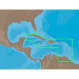
 Garmin Navionics+ Nssa010r Central America & CaribbeanSpecial Price $124.50 Regular Price $149.99
 -
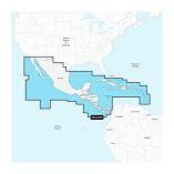
 Garmin Navionics Vision+ Nvsa010r Central America & CaribbeanSpecial Price $201.54 Regular Price $249.99


