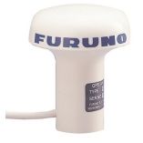
Search results for: 'FURUNO GP1850W NT GPS CHARTPLOTTER p furgp1850w nt'
- Did you mean
- furuno gp1800 nt gps chartplotter p furgp1850w nt
- furuno gp1050 nt gps chartplotter p furgp1850w nt
-
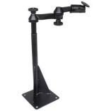 Ram Mount Universal Drill-Down Laptop Mount Swing ArmSpecial Price $230.99 Regular Price $245.99
 -
-
 Navpod Gp1037 Sailpod Pre-Cut F/Furuno Gp1920c/Nt F/9.5" Wide GuardSpecial Price $402.39 Regular Price $499.99
 -
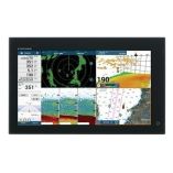 Furuno Navnet Tztouch3 16" Mfd W/1kw Dual Channel Chirp Sounder & Internal GpsSpecial Price $3,619.75 Regular Price $4,295.00
 -
 Uflex Power A Pa2-Nt Network TerminatorSpecial Price $42.55 Regular Price $49.06


