Search results for: 'Garmin Gpsmap 540s Dual Frequency Combo Internal p gar010 00615 01'
-
 Garmin Magnetic Protective Cover F/Gpsmap 9x22Special Price $136.03 Regular Price $159.99
 -
-
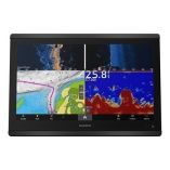
 Garmin Gpsmap 8612xsv Combo Gps/Fishfinder Gn+Special Price $2,967.28 Regular Price $4,299.99
 -
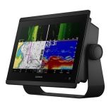
 Garmin Gpsmap 8610xsv Combo Gps/Fishfinder Gn+Special Price $2,424.91 Regular Price $2,999.99


