Search results for: 'INTERPHASE CHART MASTER V6I GPS p intu1 chrt v6i'
- Did you mean
- interphase curt master v6i gps p intl curt v6i
- interphase chart master vi gps p insul chirp vi
-
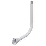 Scanstrut Apt-Gps-01 Powertower Center Mounted Bar F/Gps/Vhf/Navtex AntennaSpecial Price $164.38 Regular Price $269.00
 -
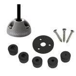
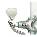 Scanstrut Lm-Gps Single Gps/Vhf Antenna Mount For Self Leveling MountsSpecial Price $110.07 Regular Price $175.00
 -
-
 Scanstrut Ds40-P Vertical Cable SealSpecial Price $38.42 Regular Price $50.99
 -

-
 Scanstrut Ds21b-P Vertical Cable SealSpecial Price $33.22 Regular Price $41.99
 -
 Scanstrut Ds21a-P Vertical Cable SealSpecial Price $35.35 Regular Price $41.99
 -

-
 Scanstrut Ds6-P Vertical Cable SealSpecial Price $22.82 Regular Price $23.99
 -
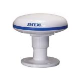
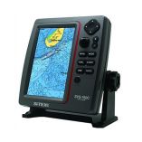 Si-Tex Standalone 7" Gps Chart Plotter System W/Color Lcd, External Gps Antenna & C-Map 4d CardSpecial Price $837.10 Regular Price $1,099.00


