Search results for: 'Maptech Chartkit Reg Book W Companion Cd Pacif p mappapregion15'
-
 Raritan Cds 12v Continuous Daly SolenoidSpecial Price $60.35 Regular Price $80.00
 -
 Scanstrut Ds40-P Vertical Cable SealSpecial Price $38.42 Regular Price $50.99
 -

-
 Scanstrut Ds21b-P Vertical Cable SealSpecial Price $33.22 Regular Price $41.99
 -
 Scanstrut Ds21a-P Vertical Cable SealSpecial Price $35.35 Regular Price $41.99
 -

-
 Scanstrut Ds6-P Vertical Cable SealSpecial Price $22.82 Regular Price $23.99
 -
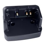 Standard Horizon Charge Cradle F/Hx380Special Price $36.34 Regular Price $40.00
 -
 Scanstrut Ds6-P-Blk Vertical Cable Seal - BlackSpecial Price $22.47 Regular Price $23.99
 -
 Scanstrut Ds40-P-Blk Vertical Cable Seal - BlackSpecial Price $37.70 Regular Price $50.99


