Search results for: 'NobelTec Odyssey Navigation Software p nobtz 0014'
- Did you mean
- nobeltec odyssey navigation software p north 0.13
- nobeltec odyssey navigation software p north 001
-
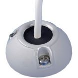
 Scanstrut Ds40-P Vertical Cable SealSpecial Price $38.42 Regular Price $50.99
 -

-
 Scanstrut Ds21b-P Vertical Cable SealSpecial Price $33.22 Regular Price $41.99
 -
 Scanstrut Ds21a-P Vertical Cable SealSpecial Price $35.35 Regular Price $41.99
 -

-
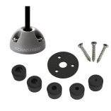 Scanstrut Ds6-P Vertical Cable SealSpecial Price $22.82 Regular Price $23.99
 -
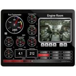 Maretron N2kview Vessel Monitoring & Control Software F/PcSpecial Price $632.67 Regular Price $695.00
 -
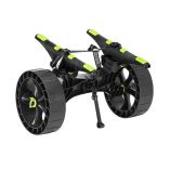 Railblaza C-Tug R W/Sandtrakz WheelsSpecial Price $199.99 Regular Price $209.99
 -
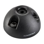 Scanstrut Ds6-P-Blk Vertical Cable Seal - BlackSpecial Price $22.47 Regular Price $23.99


