Search results for: 'Nobeltec TimeZero Trident Navigation Software p nobtz 0003'
- Did you mean
- nobeltec timezero trident navigation software p north 000
- nobeltec timezero trident navigation software p north 0183
-
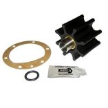
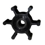 Jabsco Impeller Kit - 6 Blade - Nitrile - 2" DiameterSpecial Price $34.53 Regular Price $40.99
 -
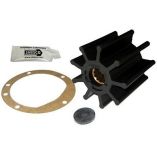
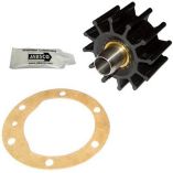 Jabsco Impeller Kit - 12 Blade - Nitrile - 2-¼" DiameterSpecial Price $102.50 Regular Price $147.99
 -
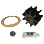
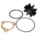 Jabsco Impeller Kit - 8 Blade - Nitrile - 1-¼" DiameterSpecial Price $43.70 Regular Price $54.99
 -
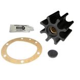 Jabsco Impeller Kit - 8 Blade - Nitrile - 2-9/16" Diameter - Spline DriveSpecial Price $46.36 Regular Price $58.99
 -
 Jabsco Impeller Kit - 8 Blade - Nitrile - 2-9/16" Diameter - Ding DriveSpecial Price $133.29 Regular Price $196.99
 -
 Jabsco Impeller Kit - 9 Blade - Nitrile - 3-3/4" Diameter X 2-1/2" W, 1" Shaft DiameterSpecial Price $67.76 Regular Price $87.99
 -
 Jabsco Impeller Kit - 9 Blade - Nitrile - 3-3/4" Diameter X 3-1/2" W, 1" Shaft DiameterSpecial Price $196.04 Regular Price $294.99
 -
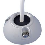
 Scanstrut Ds40-P Vertical Cable SealSpecial Price $38.42 Regular Price $50.99
 -

-
 Scanstrut Ds21b-P Vertical Cable SealSpecial Price $33.22 Regular Price $41.99
 -
 Scanstrut Ds21a-P Vertical Cable SealSpecial Price $35.35 Regular Price $41.99


