Search results for: 'GARMIN GPSMAP 4012 p gar010 00592 00'
-
 Garmin Magnetic Protective Cover F/Gpsmap 9x19Special Price $128.09 Regular Price $149.99
 -
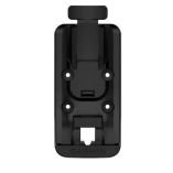 Garmin Powered Mount F/Gpsmap 86 SeriesSpecial Price $89.19 Regular Price $99.99
 -