Search results for: 'GARMIN GPSMAP 535S DUAL BEAM TRANSDUCER INLAND G p gar010 00600 01'
-

-
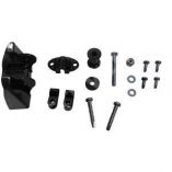
 Garmin Transom/Trolling Motor Mount Dual Beam Transducer - 8 PinSpecial Price $84.44 Regular Price $99.99
 -
 Garmin Magnetic Protective Cover F/Gpsmap 9x22Special Price $136.03 Regular Price $159.99
 -
 Garmin Panoptix Lvs32-Th Transducer Thru-Hull MountSpecial Price $1,404.77 Regular Price $1,799.99
 -
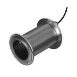 Garmin Gt15m-Thf 12 Degree 600w Ss Thru-Hull TransducerSpecial Price $612.93 Regular Price $799.99
 -
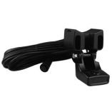
 Garmin Replacement Transducer Bracket F/Plastic Tm Transducer W/Depth & TempSpecial Price $20.75 Regular Price $20.91


