Search results for: 'Garmin Gpsmap541s Reman Us Coastal Without Transdu p gar010 n0762 02'
-
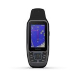 Garmin Gpsmap79sc **Remanufactured** With Sensors Built-In Bluechart G3 CoastalSpecial Price $260.61 Regular Price $279.99
 -
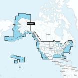 Garmin Navionics+ Nsus001l Us & Coastal CanadaSpecial Price $163.02 Regular Price $199.99
 -
 Garmin 010-12000-02 Dvi-D 10 Meter CableSpecial Price $77.14 Regular Price $79.99
 -
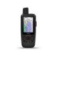
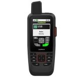 Garmin Gpsmap 86sci Handheld W/Inreach & Bluechart G3 Coastal ChartsSpecial Price $599.99 Regular Price $699.99
 -
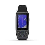 Garmin Gpsmap 79sc Handheld GpsSpecial Price $306.91 Regular Price $369.99
 -
 Garmin Gpsmap86sci **Remanufactured** Handheld Gps With Inreach Bluechart G3 U.S.Special Price $449.99 Regular Price $519.99


